
Urbanisation Pattern of Incipient Mega Region in India
Abstract
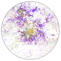
The focus of the current study is to analyse the spatial patterns of urbanisation and sprawl in Pune city using temporal remote sensing data
Downloads
References
Alphan, H., Doygun, H., & Unlukaplan, Y.I. (2009). Post-classification comparison of land cover using multi-temporal Landsat and ASTER imagery: the case of Kahramanmara angstrom, Turkey, Environmental Monitoring and Assessment, 151(1 – 4), 327 – 336
Bharath, S., Bharath, H.A., Durgappa D.S., & Ramachandra T.V. (2012). Landscape Dynamics through Spatial Metrics, Proceedings of India Geo Spatial Conference, Epicentre, Gurgaon, India, 7-9 February, 2012.
Bharath, H. A., Bharath, S., Sreekantha, S., Durgappa D.S., Ramachandra, T. V., (2012) “Spatial patterns of urbanization in Mysore: Emerging Tier II City in Karnataka, Proceedings of NRSC User Interaction Meet- 2012, 16th & 17th, Hyderabad, February 2012.
Bhaskar, P., (2012). Urbanization and changing green spaces in Indian cities (Case study – City of Pune), International Journal of Geology, Earth and Environmental Sciences, 2, 148- 156.
Bhatta, B., (2009). Analysis of urban growth pattern using remote sensing and GIS: A case study of Kolkata, India. International Journal of Remote Sensing, 30(18), 4733–4746.
Bhatta, B., Saraswati, S., & Bandyopadhyay, D., (2010a). Quantifying the degree-of-freedom, degree-of-sprawl, and degree-of-goodness of urban growth from remote sensing data. Applied Geography, 30(1), 96–111.
Bhatta, B., Saraswati, S., & Bandyopadhyay, D., (2010b). Urban sprawl measurement from remote sensing data. Applied Geography, 30(4), 731–740.
Census of India, available at http://censusindia.gov.in. Last accessed 10th June 2013
Chen, H.Y., Ganesan, S. & Jia, B.S., (2005). Environmental challenge for Post-reform housing development in Beijing”, Habitat International, Vol. 19, No. 3, pp. 571 – 589
City Development Plan (2006-2012), Jawaharlal Nehru National Urban Renewal Mission.
Clapman, Jr., W.B., (2003). Continuum-based classification of remotely sensed imagery to describe urban sprawl on a watershed scale, Remote Sensing of Environment, 86(3), 322 - 340
Codjoe, S.N.A., (2004). Population and land use/cover dynamics in the Volta River Basin of Ghana, 1960-2010, Ecology and Development Series No. 15, Cuvillier Verlag, Gottingen
Congalton, R. G., Oderwald, R. G., & Mead, R. A., 1983. Assessing Landsat classification accuracy using discrete multivariate analysis statistical techniques. Photogrammetric Engineering and Remote Sensing, 49, 1671-1678.
Congalton, R.G., & Green K., (2009). Assessing the Accuracy of Remotely Sensed Data: Principles and Practices. CRC Press Taylor & Francis Group, Boca Raton, FL
Congalton, R.G., (1991). A review of assessing the accuracy of classifications of remotely sensed data. Remote Sensing of Environment, 37 (1), 35-46.
Desai C.G, Patil M.B, Mahale V.D., & Umrikar, B., (2009). Application of remote sensing and geographic information system to study land use/land cover changes: a case study of Pune Metropolis, Advances in Computational Research, 1, 10 –
Di Gregorio, A., & Jansen, L.J.M., (1997). A new concept for a land cover classification system, in Proceedings of the Earth Observation and Environmental Information 1997 Conference, held at Alexandria, Egypt, from 13-16 October, 1997
Duda, R.O., Hart, P.E., Stork, D.G., (2000). Pattern Classification, A Wiley-Interscience Publication, Second Edition, ISBN 9814-12-602-0.
Gillies, R.R., Box, J.B., Symanzik, J., Rodemaker, E.J., (2003). Effects of urbanization on the aquatic fauna of the Line Greek Watershed, Atlanta – a satellite perspective, Remote Sensing of the Environment, 86(3), 411 – 412
Girardet, H. (1996). The Gaia Atlas of Cities: new directions for sustainable urban living, Gaia Books Limited, London. 1st Edition, ISBN: 1856750973.
Global Land Cover Facility (http://www.glcf.umd.edu/index.shtml). Accessed on 10th January 2013.
Grimm, N.B., Grove, J.M., Pickett, S.T.A. and Redman, C.L. (2000). Integrated approach to long-term studies of urban ecological systems, BioScience, 50(7), 571 – 584
Gustafson, E.J., (1998). Quantifying landscape spatial pattern: what is the state of the art?, Ecosystems, 1, 143–156.
Herold, M., Goldstein, N., C., Clarke, K., C., (2003). The spatiotemporal form of urban growth: measurement, analysis and modeling. Remote Sensing of the Environment, 86, 286–302.
Jansen, L.J.M. & Di Gregorio, A., (1998). The problems with current land-cover classifications: development of a new approach, in Land-cover and land-use information systems for European Policy Needs, Office for the Official Publications of the European Communities, Luxembourg, 21 – 23
Ji, C.Y., Lin, P., Li, X., Liu, Q., Sun, D., & Wang, S., (2001). Monitoring urban expansion with remote sensing in China, International Journal of Remote Sensing, 22(8), 1441 – 1455
Kong, F., Yin, H., Nakagoshi, N., James, P., (2012). Simulating urban growth processes incorporating a potential model with spatial metrics, Ecological Indicators, 20, 82-91
Lata, K.M., Sankar Rao, C.H., Krishna Prasad, V., Badrinath, K.V.S., & Raghava Swamy, (2001). Measuring urban sprawl: a case study of Hyderabad, GIS Development, 5(12).
Lillesand T., Kiefer R., Chipman J. (2003). Remote sensing and image interpretation. Wiley, New York, Fifth edition.
Liu, J., Dietz, T., Carpenter, S.R., Alberti, M., Folke, C., Moran, E. & Taylor, W.W., (2007). Complexity of coupled human and natural systems, Science, 317(5844), 1513 – 1516.
Lopez, T. del M., Aide, T.M., & Thomlinson, J.R., (2001). Urban expansion and the loss of prime agricultural lands in Puerto Rico, Ambio, 30(1), 49-54
Martinuzzi, S., Gould, W.A., & Gonzalez O.M.R., (2007). Land development, land use, and urban sprawl in Puerto Rico integrating remote sensing and population census data, Landscape and Urban Planning, 79(3 – 4), 288-297
Massey, D. S., Arango, J., Hugo, G., Kouaouci, A., & Pellegrino, A., (1999). Worlds in Motion: Understanding International Migration at the End of the Millennium, Oxford university press, ISBN: 0199282765
McGarigal, K., & Marks, B. J., 1995. FRAGSTATS: spatial pattern analysis program for quantifying landscape structure. USDA Forest Service General Technical Report PNW-351.
Mitrakis, N.E., Topalogou, C.A., Alexandridis, T.K., Theocharis, J.B., & Zalidis, G.C., (2008). A novel self-organising neuro-fuzzy multi layered classifier for land cover classification of a VHR image. International Journal of Remote Sensing, 29, 4061−4087
Molles, M., (2006). Ecology: Concepts and Applications, 4th ed. McGraw Hill, Boston, USA.
Pathan, S.K., Jothimani, P., Pendharkar, S.P. and Sampat Kumar, D., (1989). Urban land use mapping and zoning of Bombay Metropolitan Region using Remote Sensing data. J. Indian Soc. Remote Sensing, 17(3), 11-22.
Pathan, S.K., Shukla, V.K., Patel, R.G., Mehta, K, S., 1991. Urban land use mapping - A case study of Ahmedabad city and its environs. J Indian Soc Remote Sensing, 19(2), 95- 112.
Ramachandra, T.V., and Kumar, U., (2009). Geoinformatics for Urbanisation and Urban Sprawl pattern analysis, In Geoinformatics for natural resource management, Chapter 19, 235 – 272
Ramachandra, T.V., Bharath, A.H., & Durgappa, D.S., (2012a). Insights to urban dynamics through landscape spatial pattern analysis, Int. J Applied Earth Observation and Geoinformation, 18, 329-343
Ramachandra, T.V., Bharath, A.H., & Sreekantha, S., (2012b). Spatial Metrics based Landscape Structure and Dynamics Assessment for an emerging Indian Megalopolis, International Journal of Advanced Research in Artificial Intelligence, 1(1), 48-57.
Ramachandra, T.V., Bharath, H.A., & Vinay S., (2013). Comprehension of temporal land use dynamics in urbanising landscape., Proceedings of User Interaction Meet - 2013, Balanagar, Hyderabad, 21-22, February, 1-6.
Ramachandra, T.V., Bharath, H.A., (2012a). Spatio-Temporal Pattern of Landscape Dynamics in Shimoga, Tier II City, Karnataka State, India, International Journal of Emerging Technology and Advanced Engineering, 2(9), 563-570.
Ramachandra, T.V., Bharath, H.A., (2012d). Land Use Dynamics at Padubidri, Udupi District with the Implementation of Large Scale Thermal Power Project, International journal of Earth Sciences and Engineering, 5, 409-417.
Roth, M., Oke, T.R., & Emery, W.J., (1989). Satellite-derived Urban Heat Islands from Three Coastal Cities and the Utilization of Such Data in Urban Climatology, International Journal of Remote Sensing, 10(11), 1699 – 1720
Sudhira, H.S., Ramachandra, T.V., & Jagadish, K.S. (2003). Urban growth analysis using spatial and temporal data, Journal of the Indian Society of Remote Sensing, 31(4), 299 – 311
Sudhira, H.S., Ramachandra, T.V., & Jagadish, K.S., (2004). Urban sprawl: metrics, dynamics and modeling using GIS, International Journal of Applied Earth Observation and Geoinformation, 5(1), 29 – 39
Copyright (c) 2014 Tema. Journal of Land Use, Mobility and Environment

This work is licensed under a Creative Commons Attribution 4.0 International License.
Authors who publish in this journal agree to the following:
1. Authors retain the rights to their work and give in to the journal the right of first publication of the work simultaneously licensed under a Creative Commons License - Attribution that allows others to share the work indicating the authorship and the initial publication in this journal.
2. Authors can adhere to other agreements of non-exclusive license for the distribution of the published version of the work (ex. To deposit it in an institutional repository or to publish it in a monography), provided to indicate that the document was first published in this journal.
3. Authors can distribute their work online (ex. In institutional repositories or in their website) prior to and during the submission process, as it can lead to productive exchanges and it can increase the quotations of the published work (See The Effect of Open Access)