
Interactivity of WebGIS for the Simulation of Land Development
Abstract
In the definition of scenarios as key components underlying the decisions on city’s and territory’s transformation processes stands the comprehension of the interactions between multiple aspects that influence that dynamics. The spatial data knowledge and the development of new ICT solutions which can guide the planner towards strategic, reliable and shared decisions are essential. It is proposed a methodology in which to specialize the special approach established in previous projects developed by extending and implementing GIS technology Geographic Information System towards online interoperability. The control of the effects of changes in land use in environmental quality, particularly in the water resources management, can thus become operational in the network through the application of innovative tools able to meet the new challenges of urban regeneration.
Downloads
References
Ippolito, A.M. (Ed.). (2012). Il progetto di paesaggio come strumento di ricomposizione dei conflitti. Milano, IT: Franco Angeli Editore. ISBN: 9788820409548.
Caiaffa, E. (2006). Sistemi informativi geografici. Roma, IT: Enea Ente per le Nuove tecnologie l’Energia e l’Ambiente. ISBN: 88-8286-140-6.
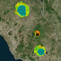
Di Giacomo, T.V. (2014). Volcanic lake basins integrated framework for landscape functionality. In C. Biscarini, A. Pierleoni, & L. Naselli Flores (Eds.), Lakes: The mirrors of the Earth. Balancing ecosystem integrity and human wellbeing. Volume 2: Proceedings of the 15th World Lake Conference (pp 264-267). Napoli, IT: Science4Press. ISBN: 978-88-96504-04-8 (print), ISBN: 978-88-96504-07-9 (online).
Leone A. (2011). Ambiente e pianificazione. Analisi, processi, sostenibilità. Milano, IT: Franco Angeli. ISBN: 9788856832778.
Longley, P. A., Goodchild, M. F., Maguire, D. J., & Rhind, D. W. (Eds.). (1999). Geographical information systems: Principles, techniques, management and applications. Second Edition. Chichester, UK: Wiley. ISBN: 978-0-471-73545-8.
Longley, P. A., Goodchild, M. F., Maguire, D. J., & Rhind, D. W. (2010). Geographic information systems and science. Third Edition. Hoboken, NJ, USA: Wiley. ISBN: 978-0-470-94809-5.
Li, W., Goodchild, M. F., Anselin, L., & Weber, K. A. (2013). A service-oriented smart cybergis framework for data-intensive geospatial problems. In M. F. Goodchild, & S. Wang (Eds.), CyberGIS: Fostering a new wave of geospatial discovery and innovation (pp. 107-123). New York, NY, USA: Springer.
Pelorosso, R., Gobattoni, F., Lopez, N., & Leone, A. (2013). Verde urbano e processi ambientali: Per una progettazione di paesaggio multifunzionale. Tema. Journal of Land Use, Mobility and Environment, 6(1), 95-111. doi: http://dx.doi.org/10.6092/1970-9870/1418.
Ripa, M. N., Leone, A., Garnier, M., & Porto, A. L. (2006). Agricultural land use and best management practices to control nonpoint water pollution. Environmental Management, 38(2), 253-266. doi: 10.1007/s00267-004-0344-y.
Secchi B. (2000). Prima lezione di urbanistica. Bari, IT: Laterza. ISBN: 8842060607.
Wong, T.H.F., Allen, R., Brown, R.R., Deleti, A., Gangadharan, L., Gernjak, W., Jakob, C., Johnstone, P., Reeder, M., Tapper, N., Vietz, G., & Walsh, C.J. (2011). Stormwater management in a water sensitive city: Blueprint 2011. Melbourne, AU: Cooperative Research Centre for Water Sensitive Cities. ISBN: 9781921912009.
World Water Assessment Programme. (2012). The United Nations World Water Development Report. Paris, FR: UNESCO. ISBN: 978-92-3-104235-5.
WHO/UNICEF. (2013). Progress on sanitation and drinking water. 2013 update: Joint Monitoring Programme for Water Supply and Sanitation. Geneva, CH: World Health Organization. ISBN: 978-92-4-150539-0.
Copyright (c) 2015 Tema. Journal of Land Use, Mobility and Environment

This work is licensed under a Creative Commons Attribution 4.0 International License.
Authors who publish in this journal agree to the following:
1. Authors retain the rights to their work and give in to the journal the right of first publication of the work simultaneously licensed under a Creative Commons License - Attribution that allows others to share the work indicating the authorship and the initial publication in this journal.
2. Authors can adhere to other agreements of non-exclusive license for the distribution of the published version of the work (ex. To deposit it in an institutional repository or to publish it in a monography), provided to indicate that the document was first published in this journal.
3. Authors can distribute their work online (ex. In institutional repositories or in their website) prior to and during the submission process, as it can lead to productive exchanges and it can increase the quotations of the published work (See The Effect of Open Access)