
Measuring Spatial Accessibility for Elderly. An Application to Subway Stations in Milan
Abstract
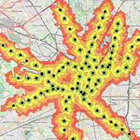
This paper presents a method for mapping and measuring accessibility to subway stations for elderly. The methodology measures pedestrian accessibility by means of isochrones to specific urban functions, for quantifying the total amount of elderly people living within each isochrones and for evaluating the presence of services around each station. In particular, a real application on Milan city is carried out with the most updated available data.Main aim is the identification of neighborhoods that present more accessibility problems. The number of inhabitants, and in particular of aged persons living in less accessible areas are therefore quantified, such as the number of activities located within walking distance are counted. The methodology can be applied to different contexts and can be furtherly improved by integrating other information in the model. Accessibility analysis has an increasing role in policy making and evaluation for policies targeted towards social inclusion. because poor pedestrian infrastructures can hinder the potential movement of an increasing amount of urban population.
Downloads
References
Achuthan, K., Titheridge, H., & Mackett, R. L. (2010). Mapping accessibility differences for the whole journey and for socially excluded groups of people. Journal of Maps, 6(1), 220-229. doi: https://doi.org/10.1080/jom.2007.9710829
Christensen, K., Doblhammer, G., Rau, R., & Vaupel, J. W. (2009). Ageing populations: The challenges ahead. The Lancet, 374(9696), 1196-1208. doi: https://doi.org/10.1016/S0140-6736(09)61460-4
Daconto, L., Colli, E., & Zizzari, S. (2018). Elderly People’s accessibility to food opportunities in Milan. Sociologia Urbana e Rurale. doi: https://doi.org/10.3280/SUR2018-115-S1006
Fernández-Mayoralas, G., Rodrı́guez, V., & Rojo, F. (2000). Health services accessibility among Spanish elderly. Social Science & Medicine, 50(1), 17-26. doi: https://doi.org/10.1016/S0277-9536(99)00247-6
Fobker, S., & Grotz, R. (2006). Everyday mobility of elderly people in different urban settings: The example of the city of Bonn, Germany. Urban Studies, 43(1), 99-118. doi: https://doi.org/10.1080%2F00420980500409292
Forbes, J. (1964). Mapping accessibility. Scottish Geographical Magazine, 80(1), 12-21
Haklay, M. (2010). How good is volunteered geographical information? A comparative study of OpenStreetMap and Ordnance Survey datasets, Environment and planning. B, Planning & design, 37(4), p. 682. doi: https://doi.org/10.1068/b35097
Lin, T. G., Xia, J. C., Robinson, T. P., Goulias, K. G., Church, R. L., Olaru, D., et al. (2014). Spatial analysis of access to and accessibility surrounding train stations: A case study of accessibility for the elderly in Perth, Western Australia. Journal of Transport Geography, 39, 111-120. doi: https://doi.org/10.1016/j.jtrangeo.2014.06.022
Mavoa, S., Witten, K., McCreanor, T., & O’sullivan, D. (2012). GIS based destination accessibility via public transit and walking in Auckland, New Zealand. Journal of Transport Geography, 20(1), 15-22. doi: https://doi.org/10.1016/j.jtrangeo.2011.10.001
Metz, D. H. (2000). Mobility of older people and their quality of life. Transport Policy, 7(2), 149-152. doi: https://doi.org/10.1016/S0967-070X(00)00004-4
Mooney, P & Minghini, M. (2017). A Review of OpenStreetMap Data. In: Foody, G, See, L, Fritz, S, Mooney, P, Olteanu-Raimond, A-M, Fonte, C C and Antoniou, V. (eds.) Mapping and the Citizen Sensor. Pp. 37–59. London: Ubiquity Press. doi: https://doi.org/10.5334/bbf.c
OECD (2015), Ageing in Cities, OECD Publishing, Paris. doi: https://doi.org/10.1787/9789264231160-en
O'Sullivan, D., Morrison, A., & Shearer, J. (2000). Using desktop GIS for the investigation of accessibility by public transport: An isochrone approach. International Journal of Geographical Information Science, 14(1), 85-104. doi: https://doi.org/10.1080/136588100240976
Pirie, G. H. (1979). Measuring accessibility: A review and proposal. Environment and Planning A, 11(3), 299-312
Rosenbloom, S. (1988). The mobility needs of the elderly. Transportation in and Aging Society, Improving Mobility and Safety for Older Persons, 2, 21-71. doi: https://doi.org/10.17226/11354
Ramm, F., Topf, J., & Chilton, S. (2011). OpenStreetMap: using and enhancing the free map of the world. Cambridge: UIT Cambridge.
WHO (2015). World report on ageing and health. Editors: World Health Organization
Zielstra, D., & Hochmair, H. (2011). Comparative study of pedestrian accessibility to transit stations using free and proprietary network data. Transportation Research Record: Journal of the Transportation Research Board, (2217), 145-152. doi: https://doi.org/10.3141/2217-18
Copyright (c) 2018 Tema. Journal of Land Use, Mobility and Environment

This work is licensed under a Creative Commons Attribution 4.0 International License.
Authors who publish in this journal agree to the following:
1. Authors retain the rights to their work and give in to the journal the right of first publication of the work simultaneously licensed under a Creative Commons License - Attribution that allows others to share the work indicating the authorship and the initial publication in this journal.
2. Authors can adhere to other agreements of non-exclusive license for the distribution of the published version of the work (ex. To deposit it in an institutional repository or to publish it in a monography), provided to indicate that the document was first published in this journal.
3. Authors can distribute their work online (ex. In institutional repositories or in their website) prior to and during the submission process, as it can lead to productive exchanges and it can increase the quotations of the published work (See The Effect of Open Access)