
Searching for Ariadne’s thread. Some remarks on urban resilience and orientation
Abstract
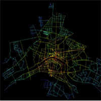
This paper concerns the methods of analysis of the configuration of the urban grids. More in details, it will focus on the configurational approach to the analysis of urban settlements, briefly presenting the different methods and techniques it has inspired, sketching their features, highlighting their actual utility and reminding their respective advantages and limits. Moreover, it will propose the use of some further configurational parameters, suitable for describing and reproducing interesting features of urban settlements; more in details, it will cast attention onto the richness and the variety of paths within a settlement, what makes it resilient, that is capable of sustaining changes and transformations without radically modifying its inner geography. Such parameters have been tested on the case studies of Pisa and Venice, which can easily be recognised as particularly relevant and significant, in that the results they provide are diametrically different. Those outputs will then be presented and discussed; the findings are suitable for suggesting resilience as a singular clue for urban orientation, so that the configurational techniques can be proposed as a tool for evaluating and predicting this spatial attitude, here finding an Ariadne’s thread for urban wayfinding.Downloads
References
Batty M. (2001) Exploring isovist fields: space and shape in architectural and urban morphology, Environment and Planning B: Planning and Design 28, 123-150.
Bortoli M., Cutini V. (2001) Centralità e uso del suolo urbano. L’analisi configurazionale del centro storico di Volterra, Pisa: ETS.
Crucitti P. Latora V., Porta S. (2006) Centrality in networks of urban streets, Chaos, vol. 16, 015113.
Cutini V. (2001) Centrality and LandUse: Three Case Studies on the Configurational Hypothesis, Cybergeo, Revue Européenne de Geographie, n. 188, 26 mars 2001.
Cutini V. (2010)La rivincita dello spazio urbano.L’approccio configurazionale all’analisi e allo studio dei centri abitati, Pisa: Pisa University Press.
Cutini V., Petri M., Santucci A. (2004) From axial maps to Mark Point Parameter Analysis (Ma.P.P.A.). A G.I.S. implemented method to automate configurational analysis, AA.VV., Computational Science and its Applications – ICCSA 2004 – Lecture Notes in Computer Science, vol. 3044, pp. 1107-1116.
CutiniV., Rabino G. (2011) Does Accessibility shape land use? Or, does land use shape accessibility Or do both?, in (a cura di
M. Pezzagno e S. Docchio) Atti della XVIII Conferenza internazionale Living and walking in cities. Sustainable mobility and road safety, 16-17 giugno 2011. pp 1-8 (forthcoming)
Hillier B. (1996a) Space is the Machine. A configurational theory of architecture, Cambridge: Cambridge University Press.
Hillier B. (1996b) Cities as Movement Economies, Urban Design International, 1, vol. 1, p.29-60.
Hillier B. (2000) Centrality as a process: account for attraction inequalities in the deformed grids, Urban Design International, vol. 3/4, pp. 107-127.
Hillier B., Hanson J. (1984) The Social Logic of Space, Cambridge: Cambridge University Press.
Hillier B., Penn A., HansonJ., Grajevski T, Xu J. (1993) Natural movement: or, configuration and attraction in urban pedestrian movement, Environment and Planning B, Planning and Design, vol. 20, pp. 67-81.
Porta S., Crucitti P., Latora V. (2006) The network analysis of urban streets: a primal approach, Environment and Planning B: Planning and Design, volume 33, pp. 705-725.
Rabino G. (2011) La città densa-rarefatta. Le trasformazioni urbane tra concentrazione e dispersione, in Atti della XIV conferenza SIU- Abitare l’Italia.Territori, economie,diseguaglianze, 24-26 marzo 2011, www.planum.net, pp. 1-7.
Ratti C. (2004) Space Syntax: some inconsistencies, Environment and Planning B: Planning and Design, vol. 31, pp. 487-499.
Turner A. (2005) Could A Road-centre Line Be An Axial Line In Disguise? Proceedings of the 5rd Space Syntax Symposium, vol. 1, Delft, pp. 145-159.
Turner A., Doxa M., O’Sullivan D., Penn A. (2001) From isovists to visibility graphs: a methodology for the analysis of architectural space, in Environment and Planning B: Planning and Design, vol. 28, pp. 103-121.
Copyright (c) 2014 Tema. Journal of Land Use, Mobility and Environment

This work is licensed under a Creative Commons Attribution 4.0 International License.
Authors who publish in this journal agree to the following:
1. Authors retain the rights to their work and give in to the journal the right of first publication of the work simultaneously licensed under a Creative Commons License - Attribution that allows others to share the work indicating the authorship and the initial publication in this journal.
2. Authors can adhere to other agreements of non-exclusive license for the distribution of the published version of the work (ex. To deposit it in an institutional repository or to publish it in a monography), provided to indicate that the document was first published in this journal.
3. Authors can distribute their work online (ex. In institutional repositories or in their website) prior to and during the submission process, as it can lead to productive exchanges and it can increase the quotations of the published work (See The Effect of Open Access)